Via 22.1 released

After a longer wait than usual, we are happy to finally announce Via 22.1. The new version of Via has a strong focus on public transport analysis improvements and includes several other smaller enhancements and bugfixes as well.
New and improved features
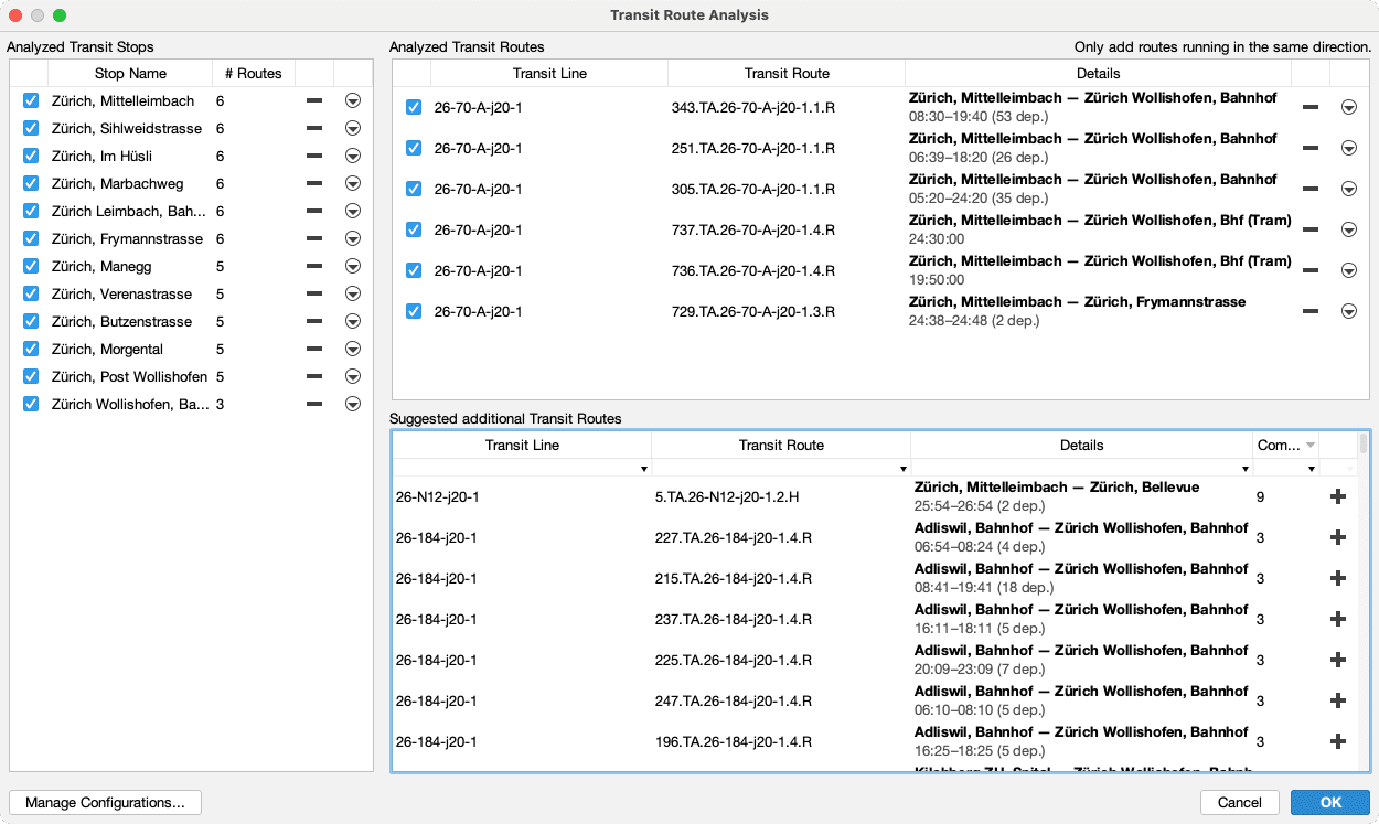
Analyze multiple transit routes
Via includes various functionality to analyze the performance of public transit routes. The more detailed public transport is modelled in MATSim, the larger the number of transit routes per line may get (e.g. having different routes or time profiles along routes for different times of day; additional partial routes during rush hours). Looking only at a single line transit route thus usually does not provide a very good picture of what’s going on. Via 22.1 now offers the functionality to analyze multiple routes—even from different lines—together as one to get a complete analysis of a network segment.

Visualization of transit analyses on the map
The aforementioned transit analysis charts usually get presented in a separate window. In Via 22.1, it is possible to visualize the aggregated values not only as charts, but directly as features on the map. This allows to quickly represent traffic flows between transit stops on the map.

Additional changes
In addition to the transit-related improvements listed above, the following smaller changes and bugfixes are also part of Via 22.1:
- Network-Export can be scripted (requires the Scripting plugin)
- Support of TSV (tab-separated values) files
- More precise activity locations when loading data from events from newer MATSim simulations.
- Show empty zones in (OD-)Aggregation Layers for a more consistent view of the data.
- Support of GeoTIFF raster images with embedded geospatial information and without separate world file.
- Various bug fixes.
Download the latest version
The new version of Via is available immediately from the Download section!